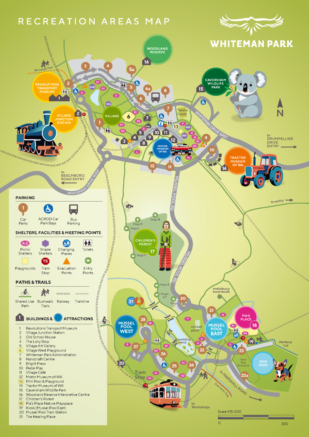
Complete with interpretive notes, our trails will let you take a closer look at the Park’s bushland and wetland areas.
NOTE - Our bush trails are closed on days when Total Fire Bans, shire Movement bans and Catastrophic Fire Danger Ratings for the Swan sub area of the Swan Inland North fire district - these closures are provided in the stories of our Facebook and Instagram pages wherever possible.
Whiteman
Park has three bushwalking trails – Werillyiup, Goo Loorto and
Wunanga – that encompass Horse Swamp, Bennett Brook and the Park’s banksia woodland respectively.
Each
bush trail encompasses a different and valuable facet of the wonders
of the bushland, and all are well signposted. As the native flowers
and trees seasonally transform the landscape, displays of colour are
ensured no matter what the season, allowing you to enjoy our bush
walks any day of the year.
To help you explore these areas, and to ensure that you gain the most from the experience, we have developed a series of interpretive notes that highlight what you can expect to see and where to find it. These are available free of charge at the Visitor Information Centre.
The
Goo Lorto Trail (Red Poles)
(Goo Lorto means ‘type of eucalypt’ in the local Noongar Aboriginal language)
NOTICE - The Goo Lorto Trail is closed ~400m from the start due to METRONET rail works.
The start of this trail is still accessible and an excellent spot to meander along the true start of Bennett Brook. From winter to spring, when the water is flowing
and the chorus of frogs can be heard, the trail can become inundated but in summertime it is ideal
for wandering in the dappled shade along the drying water course,
inhaling the scent of the gum trees overhead.
PLEASE NOTE - Our bush trails are closed when the fire danger rating is Severe and above (or when the Fire Danger Index is 50+).
The
Werillyiup Trail (Blue Poles)
(Werillyiup means ‘swampy place’ in Noongar)
This is a 2.5km loop, starting at car park 23 (near the Dog Park) in Mussel Pool. The walk encompasses Horse Swamp, a seasonal and spectacular wetland, which is alive with the waterbirds that breed there from July to October, when water levels are at their highest.
Wearing appropriate footwear during the damper seasons will ensure walkers maximise their wetland experience in comfort.
A bird hide on the western edge of the Swamp allows an outstanding view of the antics of the wetland birds and is also an ideal spot to see kangaroos grazing on the swamp fringes in the morning and late afternoon.
A lookout halfway around the trail provides an aerial perspective of the wetland and an appreciation of the size and significance of the site for the resident wildlife.
You can download the Werillyiup trail map below, or pick one up from the Visitor Information Centre in the Village.
The
Wunanga Trail (Yellow/Orange Poles)
(Wunanga means ‘quiet’ or ‘peaceful’ in Noongar)
This is a 4.3km long trail set in a figure-of-eight design to allow walkers an abbreviated version should they be time-limited.
It commences adjacent to the Village Junction Railway Station (near car park 2) and winds its way through a number of vegetation types, allowing walkers to experience the amazing diversity that the Park’s woodland has to offer. This includes jarrah, marri and banksia coastal plain bushland.
The understorey is alive with flowering shrubs throughout the year, although in the cooler spring months, eagle eyed walkers can enjoy trigger plants and orchids in an array of colours and forms.
You can download the Wunanga trail map below, or pick one up from the Visitor Information Centre or Revolutions Transport Museum (at the start of the trail) in the Village.